Wisconsin GIS Maps
UPDATED!
What is GIS? GIS or Geographic Information Systems is a mix of hardware and software to collect data for analyzing purposes that lets end users view maps and graphical data like charts & graphs. This can help individuals, business, groups etc… find trend and patterns. Real Estate Companies can use it for finding property location, dimensions and even aerial photos. Below you will find a List of WI GIS Maps organized by county.
NEW More Wisconsin Real Estate Tools at https://thelandman.net/wisconsin-real-estate-tools.html
WI GIS
If your wanting County Tax Land Records CLICK HERE
Who Uses GIS?
- Businesses
- Government including DNR – Department of Natural Resources
- Schools & Universities
- Utility Companies
- Real Estate Companies
US SOIL SURVEY - https://websoilsurvey.sc.egov.usda.gov/App/WebSoilSurvey.aspx
GIS WI
A lot of times GIS maps will be mixed in with County Land Records or County Tax Records because you can use the GIS maps to find Tax Parcels or Land Records.
Wisconsin Department of Natural Resources Geographic Information Systems Mapping ( WI DNR GIS Maps ) - https://data-wi-dnr.opendata.arcgis.com/
What is an Acre? With Acreage Calculator - https://thelandman.net/what-is-an-acre.html
More DNR Maps - https://dnr.wisconsin.gov/maps/AppList
Wisconsin Electric Company Territory Map - https://psc.wi.gov/SiteAssets/Maps/Electric_Service_Territory_30x42_PUBLIC.pdf
DNRWI Wildfire Map - Lookup Fire information with Date Filters with Fire Report Status including Fire Name, Location, Cause, Saved & Lost Structures, Acreage burnt, etc... - https://dnrmaps.wi.gov/wildfiredashboard/
Wisconsin Power Outage Mapping by County - https://poweroutage.us/area/state/wisconsin

US Debt Clock - Lots of World, US National & State Economical Information including Homes Sales, Loan Calculator and much more... - https://usdebtclock.org/
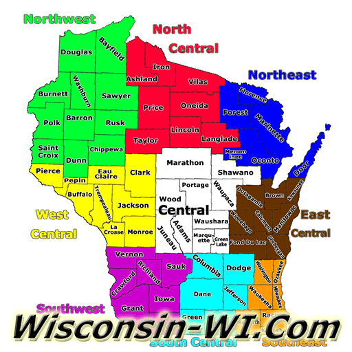
GIS WI Maps by Counties
Please note that most of the website you need to agree to terms of service and all links open in a new window. ALSO these links are constantly changing contact us if you find a broken link.
Adams County - https://adams-county-wi.maps.arcgis.com/apps/webappviewer/index.html?id=73f6922604844b9faeeae09c865a0f8d & Zoning (Extra Layers) - https://adams-county-wi.maps.arcgis.com/apps/webappviewer/index.html?id=75732dd4741b44a5b599ad197db17a1e
Ashland County - http://ashlandcowi.wgxtreme.com/
Barron County - http://barroncowi.wgxtreme.com
Bayfield County - http://maps.bayfieldcounty.org/BayfieldFlexViewer/
Brown County - https://browncounty.maps.arcgis.com/apps/webappviewer/index.html?id=61fba3fd419045e48aa6ba759838387c
Buffalo County – http://buffalocowi.wgxtreme.com/
Burnett County - http://burnettcowi.wgxtreme.com/
Calumet County - http://calumetcowi.wgxtreme.com/
Chippewa County - http://chippewacowi.wgxtreme.com
Clark County - http://clarkcowi.wgxtreme.com/
Columbia County - https://cclid.maps.arcgis.com/apps/webappviewer/index.html?id=7a63f29f8fec4f8cbb0fd674a225fd69
Crawford County - http://crawfordcowi.wgxtreme.com/
Wisconsin GIS
Dane County - https://dcimapapps.countyofdane.com/dcmapviewer/
Dodge County - http://dodgecowi.wgxtreme.com/
Door County - http://map.co.door.wi.us/map
Douglas County - http://douglascowi.wgxtreme.com
Dunn County - https://dunncowi.wgxtreme.com/
Eau Claire County - http://eauclairecowi.wgxtreme.com
Florence County - https://gis.florencewisconsin.com/integrator/Web/Default.aspx?server=mapguide&SiteId=0083b543-027c-48fc-87d5-413c267b332d#map=1/379677.93/156296.07/0
Fond du Lac County - https://gisweb.fdlco.wi.gov/fonddulacts/
Forest County - http://forestcowi.wgxtreme.com/
Grant County - https://swwigis.ags.ruekert-mielke.com/
Green County - http://landrecords.greencountywi.org/GreenCountyTaxParcelMap/
Green Lake County - http://gis.co.green-lake.wi.us/gisweb/GIS_Viewer/
Iowa County - https://swwigis.ags.ruekert-mielke.com/
Iron County - https://maps.ags.ruekert-mielke.com/Html5Viewer/index.html?viewer=ironcounty
Jackson County - http://jacksoncowi.wgxtreme.com
Jefferson County - https://jeffarcgis.jeffersoncountywi.gov/apps/PublicGISmr/
Juneau County - http://juneaucounty.maps.arcgis.com/apps/webappviewer/index.html?id=ba201516e5ed4c289d33150f640fdfb2
Kenosha County - http://kc-web-01.kenoshacounty.org/InteractiveMapping/
Kewaunee County - https://maps.ags.ruekert-mielke.com/SilverlightViewer/Viewer.html?Viewer=KewauneeCoPublic
La Crosse County - http://lacrossecounty.maps.arcgis.com/apps/webappviewer/index.html?id=dfb4ce4831654010bed9aa9d258d5ad0
Lafayette County - http://lafay.maps.arcgis.com/apps/webappviewer/index.html?id=2b7233d6dbf2418c9ced28f6b7e836d1
Langlade County - http://langladecowi.wgxtreme.com/
Lincoln County - https://maps.co.lincoln.wi.us/GISViewer/
Manitowoc County - https://manitowocmaps.info/gisviewer/
Marathon County - https://maps.co.marathon.wi.us/Html5Viewer/index.html?viewer=ExternalMapsNew
Marinette County - https://mcgis.marinettecounty.com/Integrator/Web/Default.aspx?server=mapguide&SiteId=d7b0682e-4f11-4ed1-8f24-5a769daef1c1
Marquette County - https://hub-marqco.hub.arcgis.com/app/80c3dc4524c7483b9b9c51f1d86aeca5 - Zoning - https://hub-marqco.hub.arcgis.com/app/3b2b04e7315340ffbc40fbde044cedeb - UPDATED!
Menominee County – http://www.co.menominee.wi.us/departments/?department=92b0ec46889a&subdepartment=36e3a1f6f4e5
County Aerial Maps
Milwaukee County - https://apps.geocortex.com/webviewer/?app=00d9853f922845a5841e0123918a449a
Monroe County - http://monroecowi.wgxtreme.com/
Oconto County - https://oc17maps.co.oconto.wi.us/Html5Viewer/index.html?viewer=SOLO
Oneida County - https://gis.co.oneida.wi.us/gismapping/
Outagamie County - http://outagamiecowi.wgxtreme.com
Ozaukee County - https://maps.ags.ruekert-mielke.com/Html5Viewer/Index.html?viewer=ozaukeeco
Pepin County - http://pepincowi.wgxtreme.com/
Pierce County - https://piercecounty-wi.maps.arcgis.com/apps/webappviewer/index.html?id=bbae30477a1341c1901bd1bccde8d6e0
Polk County - http://polkcowi.wgxtreme.com
Portage County - http://portagecowi.maps.arcgis.com/apps/webappviewer/index.html?id=1406812931d14616a1b4577c8c288978
Price County - http://pricecowi.wgxtreme.com
Racine County - http://arcgis.racinecounty.com/MapBook/
Richland County - http://rcz.maps.arcgis.com/apps/webappviewer/index.html?id=a7d939042e444424b8ed5dec2adb3b56
Rock County - https://rockcountylio.maps.arcgis.com/home/index.html
Rusk County - https://beacon.schneidercorp.com/Application.aspx?App=RuskCountyWI&PageType=Map
Saint Croix County - http://stcroixcowi.wgxtreme.com/
Sauk County - https://gis.co.sauk.wi.us/TaxParceliSite/
Sawyer County - http://sawyercowi.wgxtreme.com/
Shawano County - https://maps.co.shawano.wi.us/scgisviewer/
Sheboygan County - https://shebco.maps.arcgis.com/apps/webappviewer/index.html?id=35e7695029f9494981dc1a18a47a9e5f
Taylor County - https://beacon.schneidercorp.com/Application.aspx?App=TaylorCountyWI&PageType=Map
Wisconsin County Zoning
Trempealeau County - https://map.co.trempealeau.wi.us/
Vernon County - https://apps.vernoncounty.org/vcgis/apps/webappviewer/index.html?id=7731a7d9254c4ed6afb750763659914a
Vilas County - https://vilas.maps.arcgis.com/apps/webappviewer/index.html?id=43d1ad864ed74cf19dc69fd158991d24
Walworth County - https://gisinfo.co.walworth.wi.us/oneview/
Washburn County - http://washburncowi.wgxtreme.com
Washington County - https://maps.washcowisco.gov/portal/apps/sites/#/maps/app/ad0522cf24ee4552a030697b1b0179ef
Waukesha County - https://prd1.waukcogeo.com/HTML5Viewer/?viewer=html_viewer_ext
Waupaca County - http://public1.co.waupaca.wi.us/land-records-viewer/
Waushara County - https://gis.co.waushara.wi.us/TaxParcelViewer/
Winnebago County - https://wcgis3.co.winnebago.wi.us/parcelviewer/
Wood County - https://gis.co.wood.wi.us/Land-Records-Viewer-001/index.html
Cities GIS Maps
Wisconsin Rapids - https://gis.wirapids.org/CityViewerLite/?layerID=10,11
Wisconsin Aerial Mapping
Other Popular GIS Links
Geographic Information Systems - http://www.gis.com
Wisconsin Wildlife | Animals | Trail Camera Videos | Wildlife Videos | Underwater Videos

 And then Add to Home Screen.
